How to Get to Blue Line Park's Mipo Station: The Subway Route, the Last Stretch, and the Wrong Songjeong
Blue Line Park is easy to find on a map and harder to reach than it looks. Its main station at Mipo sits at the eastern end of Haeundae Beach, and no subway exit opens onto it. I've covered the fares and ticket types in my Blue Line Park guide. This post answers the question that comes before all of that. How do you get to the start, and how do you get back?
The short answer
Take subway Line 2 to Jung-dong station, leave by Exit 7, and walk. Visit Busan, the city's official tourism site, puts that walk at 18 minutes. You're heading for Mipo station at 13 Dalmaji-gil 62beon-gil, Haeundae-gu. In Korean the address is 달맞이길62번길 13, and it's worth saving on your phone before you leave.
That's the whole route — the rest of this post is about the parts that go wrong.
From Centum City: four stops east
My hotel's side door is thirty seconds from Centum City Station, so that's where these directions begin. Heading east on Line 2, the stops run Centum City, BEXCO (Busan Museum of Art), Dongbaek, Haeundae, then Jung-dong. That's four stops, and you pass Haeundae one stop before you get off.
The fare depends on how far you ride from the station where you board. The Busan Transportation Corporation charges an adult 1,600 won by transit card for a trip of up to 10 km. Beyond that it's 1,800 won. A QR ticket costs 100 won more in each band.
The ticket gate is where this trip stalls for a lot of foreign guests. An overseas bank card won't open it, and they end up stuck at the barrier. The fix is a Korean transit card from any convenience store. I explained how that works in Paying Your Way Around Busan. Sort it out the evening before, and the subway part of the day takes care of itself.
Why Jung-dong and not Haeundae
Haeundae is the station name everyone knows, so it's the one most people pick, and it works too. Walk down to the beach, turn east along the sand, and keep going until the beach runs out at Mipo.
My pick is still Jung-dong, for a plain reason. It's the route the tourism office publishes, with a named exit and a stated walking time. I don't have an official figure for the walk from Haeundae station, and I'd rather not hand you a guess.
So the choice comes down to what you want from the walk. If you'd like the beach on the way, take Haeundae and enjoy it. If you want the route with a number attached, take Jung-dong.
Both stations have coin lockers and lifts, according to the transit operator's station pages. That's useful if you're carrying a bag you don't want on a coastal train all afternoon. Jung-dong is also the station the operator lists for Dalmaji Hill, if you want to add it to the same day.
The last stretch: use the right map
This is where people get lost, and the route is rarely the problem. Google Maps is weak for directions in Korea, and guests who follow it end up wandering. I tell everyone the same thing: use Naver Map or Kakao Map, and paste in the Korean address from above.
Download one of them before your trip — doing it on the pavement outside Exit 7 is the slow way to learn a new app.
If you're driving instead, Visit Busan lists a parking lot at the Mipo station itself.
Why start at Mipo at all
Blue Line Park has three main stations: Mipo, Cheongsapo and Songjeong. Visit Busan lists ticket offices at those three. It also says you can buy a ticket at any stop that has a ticket machine. So in principle you can join the 4.8 km line at several points.
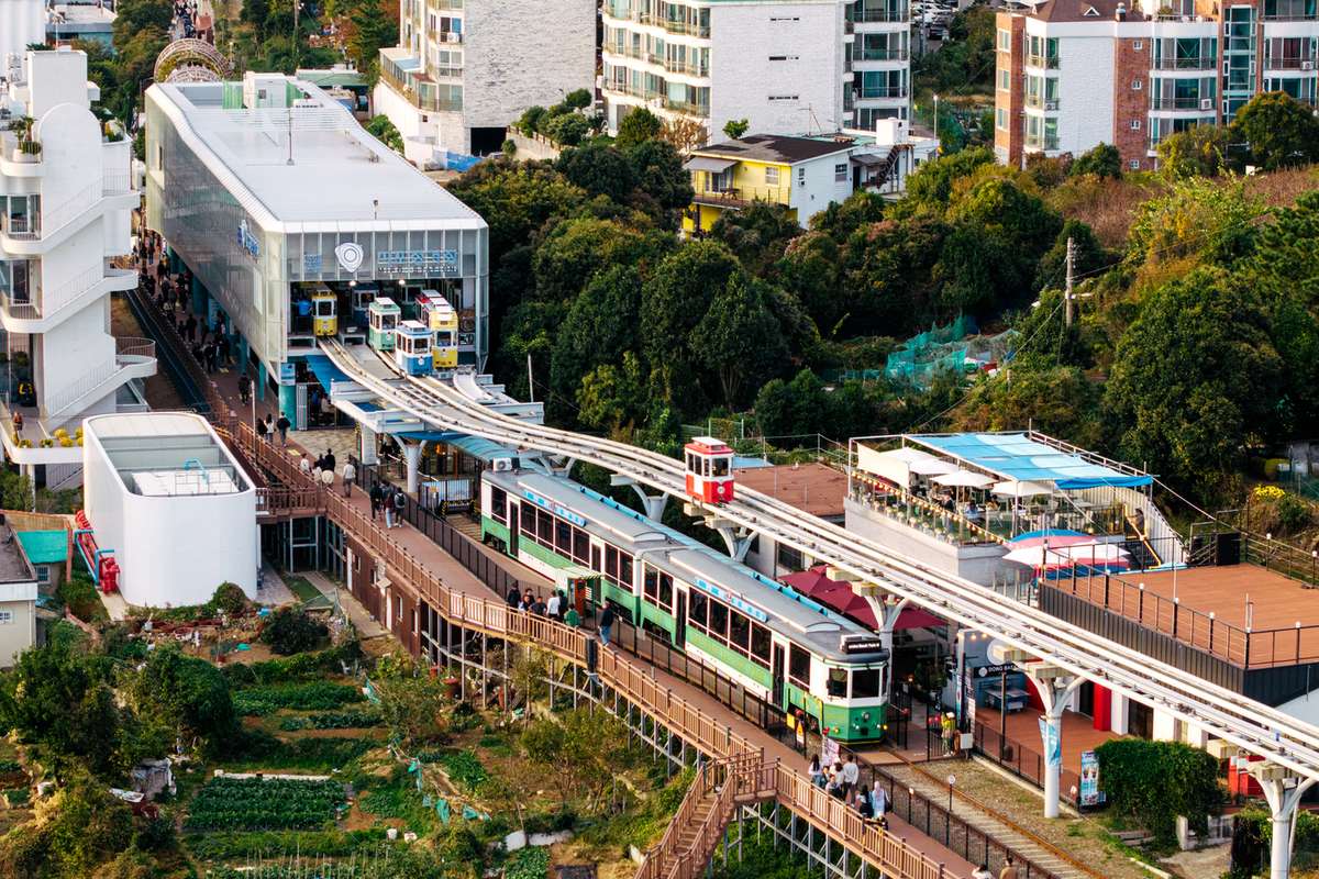
Mipo is still the right start for most people, and the reason is the Sky Capsule. It only runs the 2 km between Mipo and Cheongsapo, on a rail 7 to 10 metres off the ground. If the capsule is on your list, you board at one of those two ends. Mipo is the end the subway route actually reaches.
The honest cost is the walk. Eighteen minutes on foot is nothing on a cool morning, but with small children or a heavy bag it's the stretch of the day nobody enjoys. If that describes your group, the taxi section below is for you.
There's also a free way to do this coast. The Green Railway boardwalk runs beside the track from Mipo to Songjeong, and Visit Busan lists it as free and open all year. Paying for the ride makes sense if someone in your group can't walk far. Walking makes sense if the view is the main thing you came for. The fare tables that help you weigh it are in my Blue Line Park guide.
Coming back: the wrong Songjeong
Plenty of people ride one way and return another way, so plan the return before you leave Mipo. The beach train runs from Mipo through Cheongsapo to Songjeong. Ride it to the end and you're at the Songjeong stop, which Visit Busan lists at 299-20 Songjeong-dong.
Here's the trap: the Donghae Line commuter railway also has a station called Songjeong, and it isn't the same place. Because the names match, guests get off at the wrong one.
When you plan the way back, check which Songjeong your map app is pointing at. The beach train stop and the Donghae Line station are two different addresses. The Songjeong end gets its own section in my Songjeong post.
A taxi, if the walk is the problem
A taxi to Mipo skips the walk entirely. Show the driver the Korean address rather than the English station name.
That habit comes from my own front door. Taxi drivers don't always find my hotel on the first try, and a written Korean address is what fixes it. The same trick works for the ride back — hand over the Korean address of wherever you're staying.
For the wider picture of taxis versus the subway on this side of town, see Two Beaches, One Base.
Before you go
Line 2 to Jung-dong, Exit 7, then 18 minutes on foot by Visit Busan's figure. Get a transit card before you reach the gate. Put the Korean address into Naver Map or Kakao Map rather than Google.
Board the capsule at Mipo or Cheongsapo, and know which Songjeong you mean before you head home. If you'd like a base where the subway entrance is thirty seconds from the door, you can reach me directly at korea-busan.com.
Facts checked on 19 September 2026. Subway stops, fares and station facilities: Busan Transportation Corporation (humetro.busan.kr). Blue Line Park addresses, ticket offices, walking route, parking and boardwalk: Visit Busan (visitbusan.net).
Photo: Busan Tourism Archive (visitbusan.net), KOGL Type 1
Comments
Post a Comment